Customer Services
Copyright © 2025 Desertcart Holdings Limited
Desert Online General Trading LLC
Dubai, United Arab Emirates


🛥️ Navigate the waves with confidence and style!
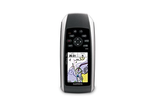
The Garmin GPSMAP 78sc is a rugged, waterproof handheld marine GPS and chartplotter featuring a 2.6-inch color display, built-in BlueChart g2 coastal maps, a high-sensitivity GPS receiver, 3-axis tilt-compensated compass, barometric altimeter, and Bluetooth for wireless data sharing. Designed for boating and watersports, it offers up to 20 hours of battery life and floats if dropped in water, making it an essential tool for serious marine navigation.

| Memory Storage Capacity | 1740 MB |
| Display Type | LCD |
| Human-Interface Input | Buttons |
| Compatible Devices | Aegean Sea & Sea of Marmara, Alborg-Amsterdam, Alpine Lakes, Bay of Biscay, Baykal & Novosibirskoe, Benelux Offshore & Inland, Canada, Caspian-Ulyanovsk-Orsk, Denmark East-Sweden Southeast, English Channel, Great Britain, Northeast Coast, Ireland, West Coast, Irish Sea, Italy, Adriatic Sea, Italy Southwest & Tunisia, Mediterranean Southeast, Portugal & Northwest Spain, Scotland, West Coast, S/E UK-Belux Inland Waters, Spain, Mediterranean Coast, Sweden Inland Waters, White Sea |
| Control Method | Voice |
| Are Batteries Included | Yes |
| Supported Satellite Navigation System | GPS |
| Sport Type | Boating |
| Battery Average Life | 20 Hours |
| Mount Type | Wrist Mount, found in image |
| Resolution | 160 x 240 |
| Compatible with Vehicle Type | Boat |
| Screen Size | 2.6 Inches |
| Additional Features | Rugged case, Barometric altimeter, Garmin Connect compatible, Electromagnetic compass, Garmin HotFix, Custom POIs, Automatic routing, Hunt/fish calendar, Geocaching, Photo navigation |
| Connectivity Technology | Bluetooth |
| Map Types | Oceania |
| Item Weight | 7.7 Ounces |
| Item Dimensions L x W x H | 2.6"L x 1.2"W x 6"H |
Trustpilot
1 week ago
1 day ago